The Land of ^Melting Snows
Click images to enlarge
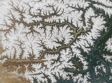 NASA image of Yarlung Tsangpo River, east Tibet: indicated by thin line at far right, curving around some 7000-metre peaks. What will happen to the river if the glaciers melt? NASA image source: Go to this page for a Mystery Image Quiz on the Tsangpo: http://photojournal.jpl.nasa.gov/catalog/PIA03708 |
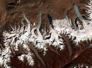 This NASA image shows glacial meltdown on the Tibet-Bhutan border from a satellite perspective. The glaciers on the upper side are in Tibet, while those on the lower side are in Bhutan. The glaciers shown here are shrinking and developing new lakes at their termini. Glacial meltwater is shown in blue on the NASA image: as glaciers melt, they form glacial lakes that swell in size. If you enlarge the NASA image, to the far lower right you can find Lugge Tsho, a lake that had a dangerous outflow in 1994 (see more about Lugge Tsho below). |
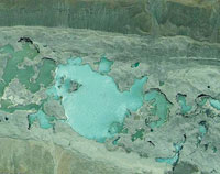
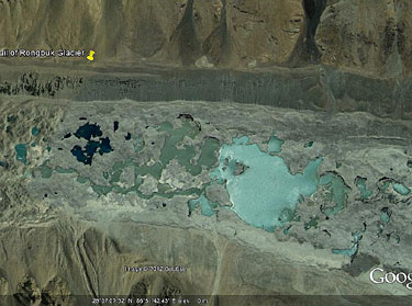 28 06 54 N, 86 51 45 E Large glacial lakes near the tail of Rongbuk Glacier, north side of Mt. Everest, Tibet. In the last 90 years the glacier's tail has lost over 90 vertical metres in depth. |
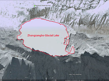 28 04 00 N, 86 03 55 Zhangzangbo Glacial Lake, Tibet Located near the Tibet-Nepal border. In July 1981, an outburst from this lake killed 5 people and injured 191, and swept way 41 houses, 12 bridges and 27 km of highway, blocking traffic for a month. |
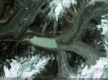 This image shows Imja Tsho, a large glacial lake in Nepal to the south of Everest. As glaciers melt, they form glacial lakes that swell in size. If a glacial lake bursts, it can cause flash floods that can sweep away roads, bridges, and entire villages. This has happened more than 30 times in the last 70 years in Nepal. When Sir Edmund Hillary made his successful expedition to the top of Everest in 1953, Imja Lake did not exist. But it is now the fastest-growing of some 1,600 glacier lakes in Nepal. |
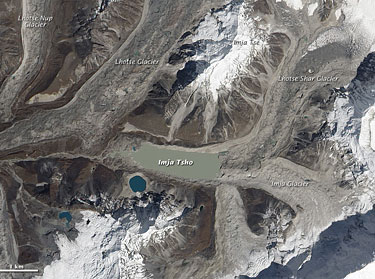 NASA image of Imja Glacier, which is part of a glacier network that ultimately feeds the Ganges River. On October 4, 2010, a NASA satellite captured this natural-colour image of Imja Tsho (Imja Lake) and surrounding glaciers. Dirt and debris coat these rivers of ice. Like the glaciers feeding it, Imja Tsho appears dull grey-brown. At its centre, the lake is about 600m wide, and according to government studies, up to 96m deep in some places. It is growing by 47 metres a year, nearly three times as fast as other glacier lakes in Nepal. |
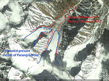 32 26 58 N, 78 02 40 E Parang Glacier, Spiti, India, has receded about 2.4 kilometres in the last 150 years. The 1847 size data comes from Thomas Thompson's Western Himalaya and Tibet. Thompson was an expert naturalist, so his observation that the glacier ended 'three miles' (4.82 kilometres) from Parang Pass is bound to be accurate. He reported the height at the lower terminus of the glacier at '100 feet' (30 metres). |
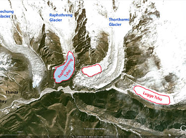 28 05 43 N, 90 17 29 E Lugge Tsho Glacier Lake, in Bhutan, had a dangerous outflow in 1994. Thanza and Tenchey, two villages downstream, lie directly in the path of a flash flood that might be created by Lugge Tsho. In the Google Earth image, the lake appears to be iced over. Glacial lake outburst flood (GLOF) events have occurred in the high-mountain areas of the Bhutan Himalaya during the past 50 years and have increased in recent years. Around 40 glacial lakes in Bhutan have been listed as highly hazardous. |